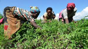
When it comes to mobile technologies, the Department of Agriculture’s National Agricultural Statistics Service has already pushed the envelope more than most agencies. Several years ago, NASS rolled out iPads to its 3,500 field enumerators – staff who visit farms around the country to collect information on crop yields, soil conditions and a variety of other data.
The deployment of iPads not only speeded the processing of data, according to Michael Valivullah, chief technology officer at the NASS, it also resulted in savings of $3 million to $5 million in printing and mailing costs.
At the same time, the deployment presented challenges. To secure the data, Valivullah’s team configured the iPads so that the collected data was transmitted immediately to the agency’s servers rather than stored on the local device. And if there was no Wi-Fi – as is common in the rural areas to which NASS enumerators are sent – the data is cached and automatically sent as soon as connectivity is restored.
While NASS’s mobile deployment has already garnered strong returns, Valivullah said he’s aiming much higher. “My main interest is to use the Internet of Things in mission-to-mission communications,” he said.
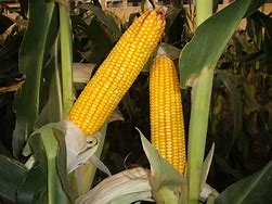
Much of the information NASS staff collects – how much land was sown with what seeds, how much water was used, how much was harvested, etc. – is automatically being collected by sensors carried by combine harvesters. “With the Internet of Things, we would be able to get the data from these onboard systems,” said Valivullah.
Merge that data with satellite data already being collected by the government, and the department, Valivullah said, will be able to make unprecedented contributions to precision agriculture. “By applying precision agriculture and big data we can increase productivity by another 10 percent to 30 percent and make farmers more profitable,” he said.
Better resolution creates more data
The key value of using combine sensors to collect data is resolution. “Satellite information has a resolution of about 100 square feet,” said Valivullah. “With sensors on combines, we could reduce that down to a resolution of 1 centimeter.”
There are two primary challenges Valivullah sees in trying to integrated combine sensor data. The first is getting access to the data. In fact, who owns the data is not clear, especially when it is collected by sensors on rented machinery. At least one private company – Climate Corp., which was purchased by Monsanto in 2013 – is looking to use combine sensor data to deliver consulting services to farmers.
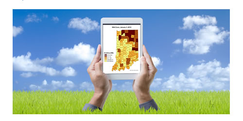
But even if the government secures access to the data, Valivullah sees challenges in managing the huge amounts of data that are collected. “Right now, to produce one cropscape map we’re taking more than 100 billion pixels,” said Valivullah. “Multiply that another 10 times and we’re talking about trillions of pixels. Do we really need to collect all that information? And if we really need it, how are we going to filter it?”
According to Valivullah, his agency has teams that meet every two weeks to generate plans for integrating the data from satellites, mobile sensors and human enumerators. “Hopefully, we will be able to design some sort of data handling methodology to deal with the big data that is going to be coming down the pike,” he said.
Credit: GCN